English
 Italian
 German
 French
Alta Maira Bikes – Gardetta
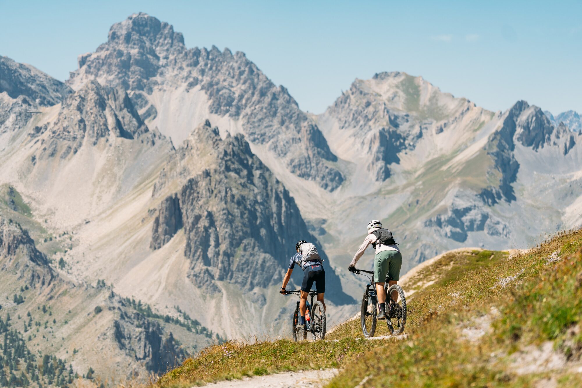
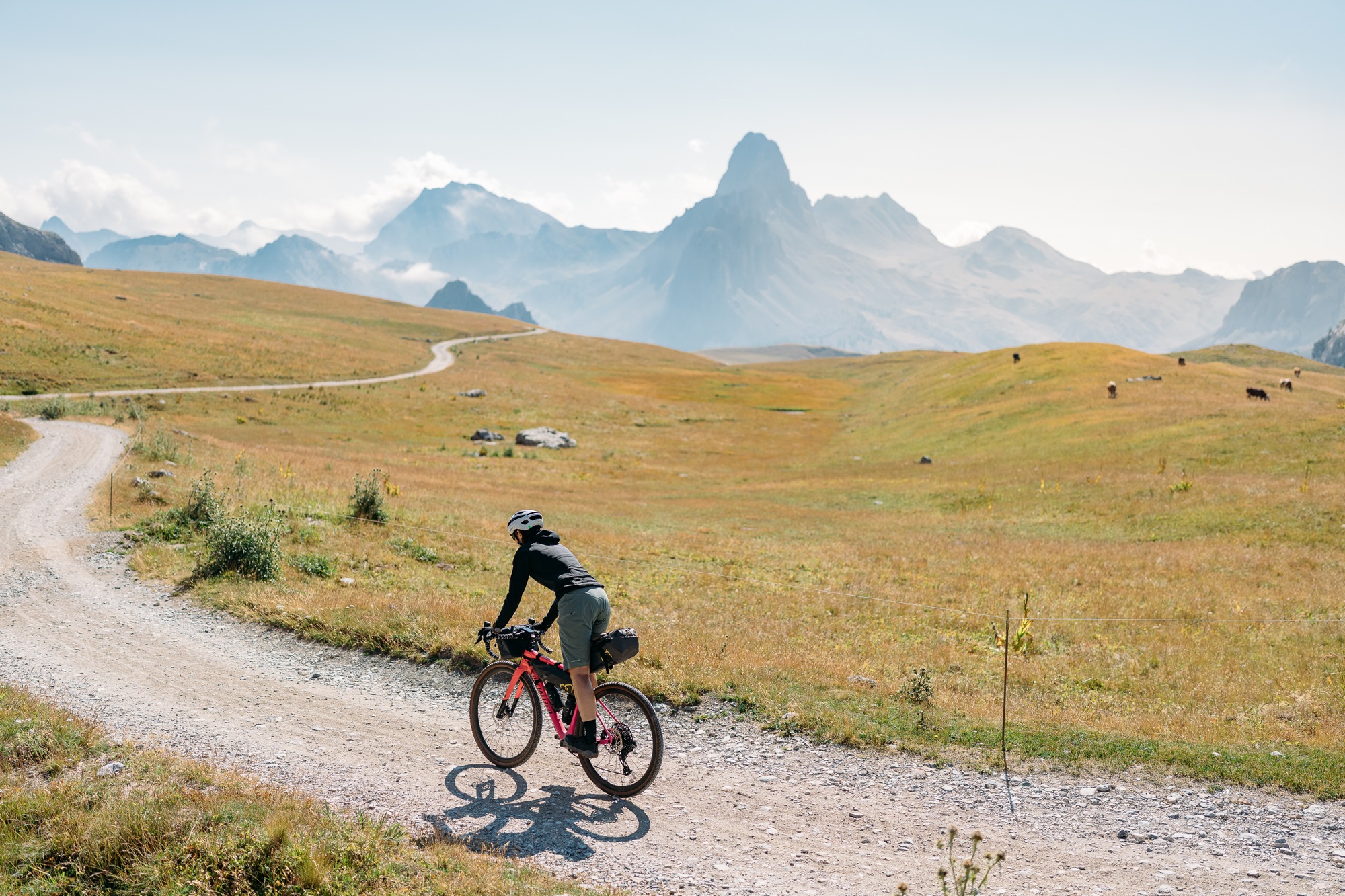
The ring develops in a high altitude alpine environment. Of particular interest is the passage to the 2,481 m of Colle del Fauniera, a nodal point between the Maira, Grana and Stura valleys, which became famous thanks to the stage of the 1999 Giro d’Italia during which Marco Pantani sprinted uphill to win the pink jersey; today a stone statue located at 2,481 meters above sea level on the hill commemorates the feat of the “pirate”. The passage on the Gardetta plateau is dominated by the dolomitic silhouette of Rocca la Meja while, descending into the Unerzio valley from the pass of the same name, the attention is focused on the 3,100 m of Mount Oronaye.
You can leave your car above the village of Prazzo Inferiore in the large car park used in winter for access to the cross-country skiing track. From there you start pedaling downhill, along the secondary road that reaches the sports fields and here you come across the “PedalMaira” cycle path which you follow in the direction of the mountain for 1.1 km when you leave it by turning left crossing the bridge over the Maira and starting the 5.6 km ascent in the dense coniferous forest.
There are no crossroads and therefore there is no possibility of making a mistake in first reaching Colletto di Canosio (1,651 meters above sea level) and subsequently San Giovanni di Canosio pass (1,650 meters above sea level). The descent takes place along the sunny slope opposite to the climb, along the narrow asphalt road until it joins the road that goes up from Canosio (1,310 meters above sea level) and which you follow, downhill, until you reach Canosio, the capital; go past the town and at the crossroads near the campsite turn right, starting to climb again towards the villages of Marmora.
After a short ride, you reach the village of Vernetti (Marmora capital) and leave the main road, passing the town hall and the post office. Still on asphalt, stay on the main axis, ignoring the junction for the village of Finello on the right. The road ends at the village of San Sebastiano where you continue straight, reaching the church of SS. Sebastiano and Fabiano, which is worth a short stop. A site of undisputed artistic value, it houses the 15th-century frescoes by Giovanni di Baleison, a medieval artist active between southern Piedmont and Liguria. In 1.2 km of dirt track, you reach the villages of Torello and Garino, after which you rejoin the asphalt road and follow it uphill towards the village of Tolosano, the last village in the valley.
A sparse larch forest accompanies the ride, which alternates between gentle slopes and more demanding sections. At 1,960 meters above sea level, you cross the wide meadows of Punte Tempesta and Sibolet, while on the opposite side, in a basin not visible unless you climb further, lies the charming Lake Resile. At 24 km from the start, you reach Gias Valanghe, a summer alpine pasture used by herdsmen for grazing livestock and producing “Nostrale dell’Alpe” cheese.
Here you have the possibility to access the Gardetta plateau through the Colle del Mulo along the dirt road on the right, but this option requires about thirty minutes of pushing the bike.
Staying instead on the road, which has a surface that is not always uniform and in good condition, follow the long final traverse that cuts across steep slopes, finally reaching Colle d’Esischie, a historic link with the Grana Valley and the municipality of Castelmagno.
Continue climbing for another 1.4 km to reach the Fauniera pass. The descent continues into the Stura Valley, and you must be careful to take the turnoff on the right for the Valcavera pass at 2,416 meters above sea level, after passing the Vallone dei Morti. A short ramp provides access to the former military road of the Gardetta plateau, allowing you to cross its entire length.
Avoid all turnoffs on both the left and right, reaching, in succession, the barracks of the Bandia pass, the Margherina pass, the Cologna pass and, at 2,315 meters above sea level, the junction with the dirt road that climbs from the Preit pass and continues beyond the barrier to the Gardetta CAI refuge.
After passing the accommodation facility (open from mid-June to mid-September), the road surface becomes more uneven and grassy, climbing up to the pass of the same name, where you avoid continuing along the military road towards Rocca Brancia and reach the pass with a wide view of the natural amphitheater of peaks bordering the French valleys of Ubayette and Ubaye (2,437 m above sea level).
Take the path that descends steeply to military works 180 and 179, bunkers whose rough and simple features represent the construction solution widely adopted in the Alpine Wall: a tunnel reaching several internal rooms equipped with embrasures.
The last part of the path before the Prato Ciorliero basin has technically challenging sections where you need to dismount and walk. From Prato Ciorliero (2,010 meters above sea level), the descent continues on a wider gravel military road, which you leave at a memorial stone (cross and plaques), taking the path on the right that descends to the beautiful village of Viviere.
Before reaching the refuge of the same name, descend to the right following the path that reaches and crosses the Unerzio stream, makes a semi-circle through the wide meadows of Pian Cassin, and reaches the village of Pratorotondo below, near an old mill. Cross the village right through the center at a moderate speed.
The path known as “La Scurcio” continues along the left bank of the stream, but as it is very popular with hikers, it is advisable to leave it, follow the paved road downhill to Chialvetta, and from there take the single-trail next to the cemetery.
Descend to Gheit, where, before the asphalt bridge, turn right and continue on the forest path to reach Frere (Acceglio) (1,196 meters above sea level).
Here, avoid crossing the stream and join the PedalMaira cycle path which, running along the right bank of the Maira stream, reaches the hamlet of Maddalena.
From here, you must continue on the SP422 at least until Prazzo Superiore, where you turn right following the cycle path signs and shortly return to the starting point of the excursion.
Information
- Ascent: 2,410 m
- Distance: 60.0 km
- Region: Prazzo
- Seasons: Autumn, Spring, Summer
- Difficulty: Hard
Mountain sports are potentially dangerous activities and must be undertaken with the right equipment and preparation. We invite you to consult the weather and avalanche bulletin before embarking on an excursion and/or contact a guide for assistance. The Valle Maira Tourist Consortium declines any responsibility in relation to the advice and itineraries shown here, which must be evaluated personally according to the weather conditions and snow cover.